...
")` |
Rich Content with HTML
Use `.setHTML()` instead of `.setText()` to add formatted text, images, links, and other HTML elements to your popup.
:::
---
### 4. Create Custom Marker Element
```js
const el = document.createElement("div");
el.id = "marker";
```
This creates a `` element that will be styled by the CSS `#marker` rule. You can add classes, data attributes, or event listeners to this element.
---
### 5. Attach Popup to Marker
```js
new bkoigl.Marker({ element: el })
.setLngLat(monument) // Position the marker
.setPopup(popup) // Attach the popup
.addTo(map); // Add to map
```
#### Marker Methods Explained
| Method | Description |
| -------------- | ---------------------------------------------------- |
| `.setLngLat()` | Set marker position `[longitude, latitude]` |
| `.setPopup()` | Attach a popup that opens when the marker is clicked |
| `.addTo()` | Add the marker to the map |
Popup Behavior
By default, popups open when you **click** the marker. Use `popup.options.closeButton = false` to remove the close button, or `popup.options.closeOnClick = false` to prevent closing when clicking the map.
:::
---
## Advanced Popup Examples
### HTML Content with Formatting
```js
const popup = new bkoigl.Popup({ offset: 25 }).setHTML(`
`);
```
### Multiple Popups on Different Markers
```js
const locations = [
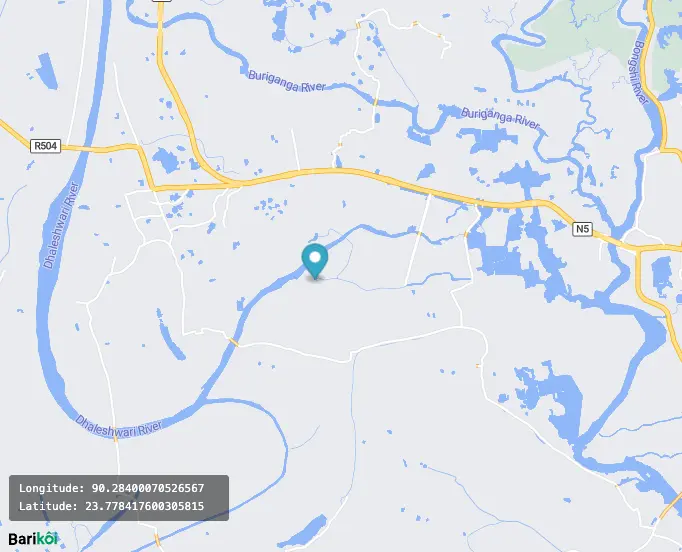
{ coords: [90.378554, 23.762607], name: "Parliament" },
{ coords: [90.406085, 23.810332], name: "Shaheed Minar" },
{ coords: [90.398575, 23.750874], name: "Lalbagh Fort" },
];
locations.forEach((loc) => {
const popup = new bkoigl.Popup({ offset: 25 }).setText(loc.name);
new bkoigl.Marker().setLngLat(loc.coords).setPopup(popup).addTo(map);
});
```
---
## Popup Configuration Options
| Option | Type | Default | Description |
| -------------- | --------- | --------- | -------------------------------------------------- |
| `closeButton` | `boolean` | `true` | Show/hide the close button |
| `closeOnClick` | `boolean` | `true` | Close popup when clicking elsewhere on the map |
| `closeOnMove` | `boolean` | `false` | Close popup when the map moves |
| `offset` | `number` | `0` | Distance between popup and anchor point |
| `anchor` | `string` | auto | Position relative to marker: `top`, `bottom`, etc. |
| `maxWidth` | `string` | `"240px"` | Maximum popup width |
Example with custom options:
```js
const popup = new bkoigl.Popup({
offset: 30,
closeButton: false,
closeOnClick: true,
maxWidth: "300px",
anchor: "bottom",
});
```
---
---
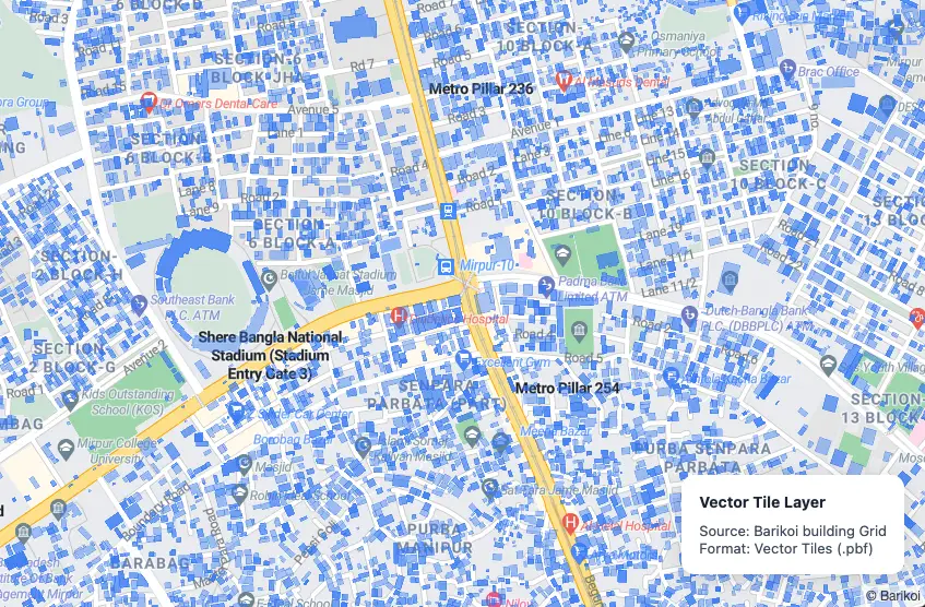
## Add Vector Tile Layer
# Add Vector Tile Layer
Load **blazing-fast vector tiles** (Mapbox Vector Tiles / MVT format) and style them dynamically. Perfect for rendering millions of features like buildings, village boundaries, land parcels, flood zones, or custom geospatial data.
---
## Quick Usage
```js
map.addSource("my-tiles", {
type: "vector",
url: "https://tiles.example.com/data/{z}/{x}/{y}",
// OR use url: "https://tiles.example.com/data/{z}/{x}/{y}.pbf",
// OR use tiles: ["https://a.tiles.example.com/{z}/{x}/{y}.pbf", ...]
});
map.addLayer({
id: "villages",
type: "fill",
source: "my-tiles",
"source-layer": "villages",
paint: {
"fill-color": "#3b82f6",
"fill-opacity": 0.3,
},
});
```
---
## Full Working Example
```html
Vector Tile Layer
Source: Barikoi building Grid
Format: Vector Tiles (.pbf)
```
---
## Key Concepts
| Term | Meaning |
| ---------------- | ------------------------------------------ |
| `type: "vector"` | Source type for .pbf tiles |
| `tiles: [...]` | Direct tile URLs (no TileJSON needed) |
| `source-layer` | Name of layer inside the .pbf file |
| `filter` | Optional: filter by geometry type or props |
---
## Performance Advantages
| Feature | Vector Tiles | GeoJSON |
| ---------------------- | ------------------------- | ----------------------- |
| File Size | Tiny (~10–50 KB per tile) | Large (MBs) |
| Rendering Speed | Extremely fast | Slow with 10k+ features |
| Zoom-dependent Styling | Yes | Limited |
| Interactivity | Full (hover, click) | Possible but heavy |
**Use vector tiles for anything over 5,000 features.**
---
## Animate Map Camera
# Animate Map Camera
Bring your map to life with **smooth, cinematic camera animations** — rotate, fly, zoom, and pitch dynamically using `flyTo`, `easeTo`, or `requestAnimationFrame`.
Perfect for:
- App intros & onboarding
- Property tours
- City flyovers
- Storytelling & presentations
- 3D building showcases
---
## Full Working Example
```html
```
---
## Camera Animation Methods
| Method | Best For | Smoothness |
| ------------------------------------------ | ---------------------- | ------------ |
| `map.flyTo()` | Cinematic jumps, tours | Highest |
| `map.easeTo()` | Gentle transitions | Very High |
| `map.jumpTo()` | Instant (no animation) | None |
| `setBearing()` + `requestAnimationFrame()` | Continuous rotation | Ultra-smooth |
**Pro Tip**: Always use `duration: 0` with `requestAnimationFrame` for 60fps rotation.
---
## Advanced: Orbital + Tilt Animation
```js
let time = 0;
function animate() {
time += 0.01;
map.setBearing(time * 20);
map.setPitch(45 + Math.sin(time) * 20);
requestAnimationFrame(animate);
}
```
Creates a **breathing orbital effect** — mesmerizing!
---
Make your map **breathtaking** — literally.
---
## Animate Point Along Line
# Animate Point Along Line
Create a **beautiful, smooth animation** of a moving icon (car, plane, ship, person) traveling along any route — with automatic rotation to follow the path.
---
## Features
- Smooth 60fps animation using `requestAnimationFrame`
- Automatic bearing rotation (icon faces direction of travel)
- Replay button
- Works with any route (curved or straight)
- Powered by **Turf.js** for precise geodesic calculations
---
## Full Working Example
```html
```
---
## Popular Use Cases
| Icon | Use Case |
| ------ | ---------------------------- |
| Car | Live delivery tracking |
| Plane | Flight path animation |
| Ship | Maritime route visualization |
| Person | Walking tour / pilgrimage |
| Bus | Public transit simulation |
---
## Customization Tips
| Want to change... | How to do it |
| ----------------- | -------------------------------------------- |
| Speed | Reduce `steps` (e.g., 300 = faster) |
| Smoothness | Increase `steps` (e.g., 1000 = ultra smooth) |
| Icon | Replace image URL with your own |
| Route | Use real GPS track or routing API |
| Auto-loop | Reset `counter = 0` when animation ends |
---
## Advanced: Real-time Vehicle Tracking
```js
// Simulate live GPS updates
setInterval(() => {
const newCoord = getLiveGPS(); // your API
arc.push(newCoord);
route.geometry.coordinates = arc;
map.getSource("route").setData(route);
}, 5000);
```
---
Bring your routes to **life** — beautifully.
---
## Click Marker to Center Map
# Click Marker to Center Map
Enable users to click any marker and have the map elegantly fly to that location. Perfect for directories, store locators, or exploring multiple points of interest.
---
## Quick Usage
```js
map.on("click", "your-layer-id", (e) => {
map.flyTo({
center: e.features[0].geometry.coordinates,
zoom: 15,
duration: 2000,
});
});
```
---
## Full Working Example
```html
```
---
## Code Breakdown
### 1. Load Custom Icon
```js
const image = await map.loadImage("url-to-icon.png");
map.addImage("custom-marker", image.data);
```
Use any PNG with transparency for beautiful custom markers.
### 2. Add Points via GeoJSON
```js
map.addSource("points", { type: "geojson", data: { ... } });
```
Best practice: Use GeoJSON for dynamic, scalable point data.
### 3. Create Clickable Symbol Layer
```js
map.addLayer({
id: "poi-markers",
type: "symbol",
source: "points",
layout: { "icon-image": "custom-marker" },
});
```
Only `symbol` layers with `icon-image` are clickable by default.
### 4. Fly to Location on Click
```js
map.on("click", "poi-markers", (e) => {
map.flyTo({
center: e.features[0].geometry.coordinates,
zoom: 15,
duration: 2000,
});
});
```
`flyTo` gives a smooth cinematic animation. Use `easeTo` or `jumpTo` for alternatives.
---
## flyTo Options
| Option | Description | Recommended Value |
| ---------- | ------------------------ | -------------------- |
| `zoom` | Target zoom level | `14–17` |
| `duration` | Animation time (ms) | `1500–2500` |
| `speed` | Speed of camera movement | `1.2` (default) |
| `curve` | How sharp the turn is | `1.42` (smooth) |
| `easing` | Timing function | Cubic Bézier (above) |
---
## Advanced: Highlight Clicked Marker
```js
let activeMarker = null;
map.on("click", "poi-markers", (e) => {
const coords = e.features[0].geometry.coordinates;
// Change icon size on click
map.setLayoutProperty("poi-markers", "icon-size", 0.04);
if (activeMarker) {
map.setLayoutProperty("poi-markers", "icon-size", 0.04);
}
// Enlarge clicked one
map.setLayoutProperty("poi-markers", "icon-size", [
"match",
["get", "name"],
e.features[0].properties.name,
0.12,
0.04,
]);
map.flyTo({ center: coords, zoom: 16 });
});
```
---
## Bonus: Fit Bounds for Multiple Points
```js
map.fitBounds(
[
[90.34, 23.7],
[90.44, 23.84],
],
{ padding: 80, duration: 2000 }
);
```
Great for "Show all locations" button.
---
Happy mapping!
---
## Display Custom Map Style
# Display Custom Map Style
Pick your vibe. One line of code changes everything.
---
## Official & Community Styles
| Style Name | Preview Mood | Style URL | Best For |
| --------------------- | ----------------------------- | ------------------------------------------------------------- | ---------------------------------- |
| **Barikoi Light** | Clean, professional | `https://map.barikoi.com/styles/barikoi-light/style.json` | Default, dashboards, web apps |
| **Barikoi Dark Mode** | Sleek, modern, night-friendly | `https://map.barikoi.com/styles/barikoi-dark-mode/style.json` | Admin panels, logistics, dark UIs |
| **Barikoi Green** | Fresh, nature-inspired | `https://map.barikoi.com/styles/barkoi_green/style.json` | Eco apps, agriculture, tourism |
| **Planet Map** | Common, realistic | `https://map.barikoi.com/styles/planet_map/style.json` | Real estate, urban planning |
| **OSM Liberty** | OpenStreetMap elegant fork | `https://map.barikoi.com/styles/osm-liberty/style.json` | Open-data lovers, clean minimalism |
Authentication
All styles require your API key via `?key=YOUR_KEY` in production (or pass `accessToken` in JS).
:::
---
## Full Working Example
```html
```
---
## Code Breakdown
### 1. Required Dependencies
```html
```
These are the same dependencies used in every Barikoi map. The CSS ensures UI elements render correctly regardless of which style you choose.
---
### 2. Full-Screen Map Container
```css
body,
html,
#map {
margin: 0;
padding: 0;
height: 100%;
width: 100%;
}
```
This makes the map fill the entire browser window. You can also use fixed dimensions:
```css
#map {
width: 800px;
height: 500px;
}
```
---
### 3. Map Initialization with Custom Style
```js
const map = new bkoigl.Map({
container: "map", // HTML element ID to render the map
center: [90.4071, 23.7925], // Starting position [longitude, latitude]
zoom: 10, // Initial zoom level
accessToken: "YOUR_BARIKOI_API_KEY", // Required for authentication
// 👇 THIS IS THE KEY LINE — change the style URL to switch themes!
style: "https://map.barikoi.com/styles/barikoi-dark-mode/style.json",
});
```
#### The `style` Property Explained
| Property | Description |
| -------------------- | ------------------------------------------------------------------------- |
| **What it is** | A URL pointing to a JSON file that defines every visual aspect of the map |
| **What it controls** | Colors, fonts, layer visibility, road widths, label placement, icons |
| **How to change** | Simply swap the URL to a different style |
---
## Switching Styles Dynamically
You can change the map style **after initialization** using the `setStyle()` method:
```js
// Switch to dark mode on button click
document.getElementById("darkBtn").addEventListener("click", () => {
map.setStyle(
"https://map.barikoi.com/styles/barikoi-dark-mode/style.json?key=YOUR_BARIKOI_API_KEY"
);
});
document.getElementById("lightBtn").addEventListener("click", () => {
map.setStyle(
"https://map.barikoi.com/styles/barikoi-light/style.json?key=YOUR_BARIKOI_API_KEY"
);
});
```
Note
Calling `setStyle()` will remove any custom layers, markers, or sources you've added. You'll need to re-add them after the style loads using the `style.load` event.
:::
---
## Style Comparison
### When to Use Each Style
| Style | ✅ Best For |
| --------------------- | ------------------------------------ |
| **Barikoi Light** | General purpose, public-facing apps |
| **Barikoi Dark Mode** | Night mode, dashboards, admin panels |
| **Barikoi Green** | Environmental apps, parks, tourism |
| **Planet Map** | Detailed city exploration |
| **OSM Liberty** | Open-source projects, minimal look |
---
---
## Fit Bounds
# Fit Bounds
Use `map.fitBounds()` to instantly frame any geographic data — whether it's a route, a group of stores, or a delivery zone — with perfect padding and smooth animation.
---
## Quick Usage
```js
const bounds = new bkoigl.LngLatBounds(
[90.35, 23.7], // southwest
[90.44, 23.84] // northeast
);
map.fitBounds(bounds, {
padding: 80,
duration: 2000,
});
```
---
## Full Working Example
```html
```
---
## How to Calculate Bounds
### Method 1: From Array of Coordinates (Recommended)
```js
const bounds = coordinates.reduce(
(b, coord) => b.extend(coord),
new bkoigl.LngLatBounds(coordinates[0], coordinates[0])
);
```
### Method 2: Manual Southwest & Northeast
```js
const bounds = new bkoigl.LngLatBounds(
[90.35, 23.7], // SW corner
[90.44, 23.84] // NE corner
);
```
### Method 3: From GeoJSON Feature
```js
const bounds = new bkoigl.LngLatBounds();
geojson.features.forEach((feature) => {
bkoigl.LngLatBounds.convert(feature.bbox || feature.geometry).extend(bounds);
});
```
---
## fitBounds Options
| Option | Type | Description | Recommended |
| ---------- | ------------- | ----------------------------------- | ---------------------------------- |
| `padding` | Number/Object | Pixels from edge | `80` or `{top:100, left:120, ...}` |
| `duration` | Number | Animation time (ms) | `1500–2500` |
| `maxZoom` | Number | Prevent zooming in too far | `16–17` |
| `bearing` | Number | Rotate map during fit | `0–360` |
| `pitch` | Number | 3D tilt | `0–60` |
| `linear` | Boolean | Disable easing (straight animation) | `false` (default) |
---
## Advanced: Fit Bounds with Custom Padding Object
```js
map.fitBounds(bounds, {
padding: {
top: 120,
bottom: 180, // Extra space for bottom UI
left: 100,
right: 100,
},
duration: 2000,
});
```
Perfect when you have a bottom sheet, sidebar, or floating controls.
---
## Pro Tip: Auto-fit on Data Load
```js
map.on("load", () => {
// Automatically fit bounds after adding data
map.fitBounds(bounds, { padding: 100, duration: 1800 });
});
```
---
Perfect framing, every time!
---
## Fly to Location
# Fly to Location
Use `map.flyTo()` to create smooth, cinematic transitions to any coordinate. Ideal for navigation buttons, "Locate HQ", or guiding users to important places.
---
## Quick Usage
```js
map.flyTo({
center: [90.4071, 23.7925], // Dhaka coordinates
zoom: 15,
speed: 1.2,
curve: 1.42,
easing: (t) => (t < 0.5 ? 4 * t * t * t : 1 - Math.pow(-2 * t + 2, 3) / 2),
});
```
---
## Full Working Example
```html
```
---
## Code Breakdown
### 1. Basic `flyTo`
```js
map.flyTo({
center: [lng, lat],
zoom: 15,
duration: 2000, // milliseconds
});
```
### 2. Advanced Animation Options
| Option | Type | Description | Best For |
| ---------- | -------- | ------------------------ | ------------------------- |
| `zoom` | Number | Target zoom level | `14–18` |
| `center` | Array | `[lng, lat]` coordinates | Required |
| `duration` | Number | Animation time (ms) | `1500–3000` |
| `speed` | Number | Speed multiplier | `0.6` (slow) – `2` (fast) |
| `curve` | Number | How sharp the turn is | `1.42` (smooth) |
| `bearing` | Number | Map rotation in degrees | `0–360` |
| `pitch` | Number | Tilt angle (3D effect) | `0–60` |
| `easing` | Function | Custom timing function | Smooth cinematic feel |
---
## Pro Tip: Smooth Easing Function
```js
easing: (t) => (t < 0.5 ? 4 * t * t * t : 1 - Math.pow(-2 * t + 2, 3) / 2);
```
---
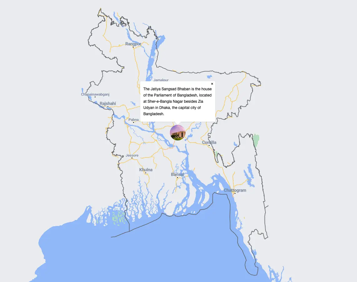
## Advanced: Fly with Marker + Popup
```js
map.flyTo({ center: coords, zoom: 16, duration: 2500 });
setTimeout(() => {
new bkoigl.Marker()
.setLngLat(coords)
.setPopup(new bkoigl.Popup({ offset: 25 }).setHTML("
Welcome!
"))
.addTo(map)
.togglePopup();
}, 2600);
```
---
## Alternative Methods
| Method | Use Case |
| ----------------- | ---------------------------------------- |
| `map.flyTo()` | Smooth cinematic animation (recommended) |
| `map.easeTo()` | Slightly faster, still smooth |
| `map.jumpTo()` | Instant jump (no animation) |
| `map.fitBounds()` | Show multiple locations at once |
---
---
## Get Mouse Position
# Get Mouse Position
Track the exact geographic coordinates (`lng`, `lat`) of the mouse as it moves or clicks on the map. Perfect for debugging, reverse geocoding, coordinate pickers, or advanced interactions.
---
## Quick Usage
```js
map.on("mousemove", (e) => {
console.log("LngLat:", e.lngLat.lng.toFixed(6), e.lngLat.lat.toFixed(6));
});
map.on("click", (e) => {
console.log("Clicked at:", e.lngLat.toArray());
});
```
`e.lngLat` → `{ lng: 90.123456, lat: 23.123456 }`
`e.point` → `{ x: 512, y: 384 }` (pixel coordinates)
---
## Full Working Example
```html
Mouse Hover Position
Move mouse over map...
Mouse Click Position
Click on map...
```
---
## Event Object Properties
| Property | Type | Description |
| ----------------- | ------------ | ------------------------------- |
| `e.lngLat` | `LngLat` | Geographic coordinates |
| `e.point` | `Point` | Pixel coordinates on map canvas |
| `e.originalEvent` | `MouseEvent` | Raw DOM mouse event |
```js
map.on("mousemove", (e) => {
console.log("Geo:", e.lngLat.toArray());
console.log("Pixel:", e.point);
});
```
---
## Common Use Cases
| Use Case | Code Snippet |
| -------------------------- | --------------------------------------------- |
| Reverse geocoding on click | `fetch('/api/reverse?lng=${lng}&lat=${lat}')` |
| Coordinate picker tool | Save `e.lngLat` to form input |
| Debug map interactions | Log `e.point` for UI testing |
| Draw on click | Use `e.lngLat` to add markers/lines |
---
## Advanced: Copy to Clipboard on Click
```js
map.on("click", (e) => {
const coords = `${e.lngLat.lng.toFixed(6)}, ${e.lngLat.lat.toFixed(6)}`;
navigator.clipboard.writeText(coords);
alert("Coordinates copied: " + coords);
});
```
---
Know exactly where your users are pointing — always!
---
## Icon Layer
# Icon Layer
Use **`symbol` layers** with custom icons to display **thousands of branded markers** efficiently — far more performant than individual `Marker` objects.
Ideal for store locators, vehicle tracking, custom POIs, or any branded point data.
---
## Quick Usage
```js
map.loadImage("https://your-icon.png").then((image) => {
map.addImage("my-icon", image.data);
map.addLayer({
id: "stores",
type: "symbol",
source: "stores-source",
layout: {
"icon-image": "my-icon",
"icon-size": 0.12,
},
});
});
```
---
## Full Working Example
```html
```
---
## Key Layout Properties
| Property | Value Example | Purpose |
| ---------------------- | -------------------------------- | ---------------------------- |
| `"icon-image"` | `"my-icon"` or `["get", "icon"]` | Static or dynamic icon |
| `"icon-size"` | `0.08 – 0.15` | Scale factor (0.1 = normal) |
| `"icon-allow-overlap"` | `true` / `false` | Show even when overlapping |
| `"icon-anchor"` | `"bottom"` | Align icon tip to coordinate |
---
## Performance Comparison
| Method | Max Markers | Best For |
| ----------------------- | ----------- | ------------------------------------- |
| `new bkoigl.Marker()` | ~100 | Few interactive markers |
| **Symbol Layer (this)** | 10,000+ | Large datasets, clustering, filtering |
**Symbol layers are 50x+ faster** than DOM markers.
---
## Advanced: Dynamic Icon from Property
```js
"icon-image": ["concat", ["get", "category"], "-icon"]
```
Works perfectly with data like `{ category: "restaurant" }`
---
---
## Interactive Code Examples
# Interactive Code Examples
Looking for hands-on examples? We've moved all our interactive code examples to a dedicated **Examples** section for better organization and discoverability.
## [View All Examples →](/examples)
### What You'll Find:
#### **Getting Started**
Perfect for your first Barikoi map integration.
- [Display a Basic Map](/examples/getting-started/display-basic-map)
- [Custom Map Styles](/examples/getting-started/display-custom-map-style)
- [Map Controls](/examples/getting-started/add-maps-control)
#### **Markers & Popups**
Add interactive markers and information windows.
- [Add a Marker](/examples/markers-and-popups/add-marker)
- [Draggable Markers](/examples/markers-and-popups/add-draggable-marker)
- [Click to Add Marker](/examples/markers-and-popups/add-marker-map-click)
- [Popups & Info Windows](/examples/markers-and-popups/add-popup)
- [Multiple Markers](/examples/markers-and-popups/multiple-marker-as-layer)
- [Animated Markers](/examples/markers-and-popups/soft-pulsing-marker)
#### **Layers & Styling**
Work with GeoJSON, lines, polygons, and custom layers.
- [GeoJSON Lines](/examples/layers-and-styling/add-geojson-line)
- [Polygons & Areas](/examples/layers-and-styling/add-polygon)
- [Multiple GeoJSON Layers](/examples/layers-and-styling/multiple-geojson)
- [Custom Icon Layer](/examples/layers-and-styling/icon-layer)
- [Vector Tiles](/examples/layers-and-styling/vector-tile-layer)
#### **Advanced Features**
Real-time tracking, animations, and interactive tools.
- [Live Real-Time Data](/examples/advanced-features/live-real-time-data)
- [Animate Along Path](/examples/advanced-features/animate-point-along-line)
- [Camera Animation](/examples/advanced-features/animate-map-camera)
- [Measure Distance](/examples/advanced-features/measure-distance)
- [Measure Area](/examples/advanced-features/measure-polygon-area)
- [Click to Center](/examples/advanced-features/click-to-center)
- [Fly to Location](/examples/advanced-features/fly-location)
- [Fit Bounds](/examples/advanced-features/fit-bound)
- [Mouse Position](/examples/advanced-features/mouse-position)
---
## 💡 Quick Links
- 📚 [Browse All Examples](/examples) - Interactive examples with live demos
- 🗺️ [Maps API Documentation](/docs/maps-api) - Complete API reference
- 🔑 [Get Your API Key](https://developer.barikoi.com) - Start building today
- 💬 [Get Support](https://barikoi.com/contact) - Need help? Contact us
Looking for something specific?
Visit the [Examples section](/examples) to see all examples organized by category with live demos and full source code.
:::
---
## Interactive Examples
# Interactive Examples
Copy-paste ready code examples to build powerful mapping applications. Each example includes a live demo, full source code, and detailed explanations.
## Getting Started
Perfect for your first Barikoi map integration.
---
## Markers & Popups
Add interactive markers and information windows.
---
## Layers & Styling
Work with GeoJSON, lines, polygons, and custom layers.
---
## Advanced Features
Real-time tracking, animations, and interactive tools.
---
## Need Help?
- [Full API Documentation](/docs/maps-api)
- [Get Your API Key](https://developer.barikoi.com)
- [Community Support](https://barikoi.com/contact)
---
## Live Real-Time Data
# Live Real-Time Data
Display **live-updating markers** that move smoothly across the map — powered by real-time data sources (WebSocket, API polling, MQTT, etc.).
Perfect for:
- Live vehicle/fleet tracking
- Flight radar
- Delivery status
- IoT sensor locations
- Ride-hailing apps
---
## Full Working Example
```html
Live Tracking Active
Vehicle ID: DHK-247
Waiting for update...
```
---
## Real-World Integration (Replace Simulation)
```js
// Example: Fetch from your backend API
setInterval(async () => {
const res = await fetch("/api/vehicles/live");
const vehicles = await res.json();
map.getSource("live-vehicles").setData({
type: "FeatureCollection",
features: vehicles.map((v) => ({
type: "Feature",
geometry: { type: "Point", coordinates: [v.lng, v.lat] },
properties: { bearing: v.heading, id: v.id },
})),
});
}, 3000);
```
Or use **WebSocket** for true real-time:
```js
const ws = new WebSocket("wss://your-api.com/live");
ws.onmessage = (event) => {
const data = JSON.parse(event.data);
map.getSource("live-vehicle").setData(data);
};
```
---
## Pro Tips
| Feature | How to Add |
| ---------------- | ------------------------------------------ |
| Smooth movement | Use `map.easeTo()` or `flyTo()` |
| Auto-follow | `map.easeTo({ center: coords, zoom: 16 })` |
| Bearing rotation | `"icon-rotate": ["get", "bearing"]` |
| Trail history | Add previous points to a `line` layer |
| Offline fallback | Cache last known position |
---
Real-time location — **beautifully alive**.
---
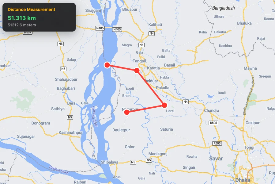
## Measure Distance on Map
# Measure Distance on Map
Let users **measure distances** by clicking on the map. Draws a polyline, shows live distance in **kilometers & meters**, and allows removing points by clicking them again.
### Features
- Click to add points
- Click an existing point to remove it
- Real-time distance calculation (Turf.js)
- Clean visual feedback with red markers & line
- Double-click zoom disabled for smooth experience
---
## Full Working Example
```html
Distance Measurement
Click map to start measuring
```
---
## How It Works
| Action | Result |
| ---------------- | -------------------------------- |
| Click empty area | Adds a red marker |
| Click a marker | Removes that point |
| 2+ points | Draws line & shows live distance |
| New click | Rebuilds entire measurement |
---
Measure anything — **instantly and beautifully**.
---
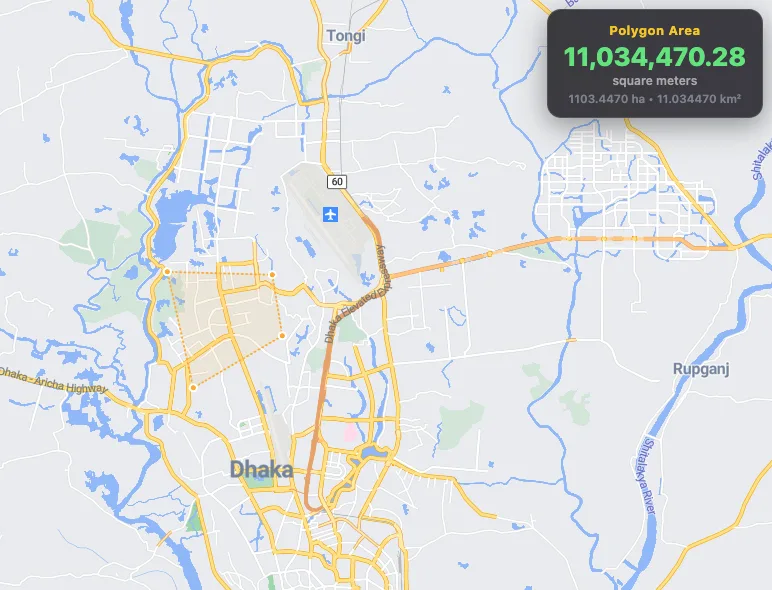
## Measure Polygon Area
# Measure Polygon Area
Let users **draw and edit polygons** directly on the map and instantly see the **real-time area** in **square meters**, **hectares**, and **square kilometers** — ideal for land measurement, property boundaries, construction planning, or agriculture.
### Features
- Draw, edit, and delete polygons freely
- Real-time area calculation using **Turf.js**
---
## Full Working Example
```html
Polygon Area
Draw a polygon to measure
```
---
## Area Units Explained
| Unit | Conversion | Best For |
| ------------ | -------------------- | ----------------------------- |
| **m²** | Base unit | Small plots, buildings |
| **Hectares** | 1 ha = 10,000 m² | Agriculture, large land |
| **km²** | 1 km² = 1,000,000 m² | City blocks, industrial zones |
---
## Pro Tips
- Use `turf.area()` — most accurate for spherical Earth
- Combine with **snap-to-roads** or **ortho imagery** for surveying
- Export drawn polygon with `draw.getAll()` → send to backend
---
---
## Multiple GeoJSON Layers
# Multiple GeoJSON Layers
Add and style multiple geometry types (points, lines, polygons) from a single GeoJSON source with independent layer controls.
## Complete Working Example
```html
```
---
## How It Works
### 1. GeoJSON Source Structure
The example uses a **FeatureCollection** containing multiple features with different geometry types:
```javascript
{
type: "FeatureCollection",
features: [
{
type: "Feature",
geometry: { type: "Polygon", coordinates: [...] } // Park boundary
},
{
type: "Feature",
geometry: { type: "Point", coordinates: [...] } // Entrance 1
},
{
type: "Feature",
geometry: { type: "Point", coordinates: [...] } // Entrance 2
}
]
}
```
### 2. Adding the GeoJSON Source
```javascript
map.addSource("national-park", {
type: "geojson",
data: {
/* GeoJSON data here */
},
});
```
| Parameter | Value | Description |
| --------- | ---------------- | ----------------------------------------------- |
| `type` | `"geojson"` | Specifies this is a GeoJSON source |
| `data` | `GeoJSON object` | Contains all features (polygons, points, lines) |
### 3. Creating Separate Layers with Filters
Each layer uses a **filter** to display only specific geometry types:
**Polygon Layer (Park Boundary):**
```javascript
filter: ["==", "$type", "Polygon"];
```
- `$type` is a special expression that checks the geometry type
- Only shows features where geometry type equals "Polygon"
**Circle Layer (Points of Interest):**
```javascript
filter: ["==", "$type", "Point"];
```
- Only shows features where geometry type equals "Point"
---
## Layer Configuration Details
### Polygon Fill Layer
```javascript
{
id: "park-boundary",
type: "fill",
source: "national-park",
paint: {
"fill-color": "#4CAF50", // Solid fill color
"fill-opacity": 0.3, // 30% opacity (semi-transparent)
"fill-outline-color": "#2E7D32" // Border color
},
filter: ["==", "$type", "Polygon"]
}
```
### Circle Layer (Points)
```javascript
{
id: "park-points",
type: "circle",
source: "national-park",
paint: {
"circle-radius": 8, // Size of the circle
"circle-color": "#FF5722", // Fill color
"circle-stroke-width": 2, // Border thickness
"circle-stroke-color": "#FFFFFF" // Border color
},
filter: ["==", "$type", "Point"]
}
```
---
## Advanced Examples
### Add LineString Features (Trails/Roads)
```javascript
// Add line features to your GeoJSON
{
type: "Feature",
geometry: {
type: "LineString",
coordinates: [
[90.399452, 23.780573],
[90.4022, 23.70109],
[90.31403, 23.7279]
]
}
}
// Create a line layer
map.addLayer({
id: "park-trails",
type: "line",
source: "national-park",
paint: {
"line-color": "#2196F3",
"line-width": 3,
"line-dasharray": [2, 2] // Dashed line
},
filter: ["==", "$type", "LineString"]
});
```
### Add Properties for Dynamic Styling
```javascript
{
type: "Feature",
geometry: { type: "Point", coordinates: [...] },
properties: {
"name": "Main Entrance",
"type": "entrance",
"status": "open"
}
}
// Style based on properties
map.addLayer({
id: "smart-points",
type: "circle",
source: "national-park",
paint: {
"circle-color": [
"case",
["==", ["get", "status"], "open"], "#4CAF50",
["==", ["get", "status"], "closed"], "#F44336",
"#9E9E9E" // default color
],
"circle-radius": [
"case",
["==", ["get", "type"], "entrance"], 10,
["==", ["get", "type"], "viewpoint"], 8,
6 // default size
]
}
});
```
---
## Common Use Cases
| Use Case | Geometry Types | Example Applications |
| ------------------------ | ------------------- | ---------------------------------- |
| **Park/Reserve Mapping** | Polygon + Points | Park boundary with entrance points |
| **Transport Networks** | LineString + Points | Roads with bus stops |
| **Building Complexes** | Polygon + Points | Building outlines with amenities |
| **Survey Data** | Points + Polygons | Sample points with area boundaries |
---
## Performance Tips
1. **Single Source vs Multiple Sources**
- ✅ Use single source when features are related (same dataset)
- ✅ Use multiple sources when data comes from different APIs or updates independently
2. **Filter Efficiency**
- Filters are applied during rendering, so all data is still loaded
- For very large datasets, consider splitting into separate sources
3. **Layer Order**
- Layers are drawn in the order they're added
- Add point layers last so they appear on top of polygons/lines
---
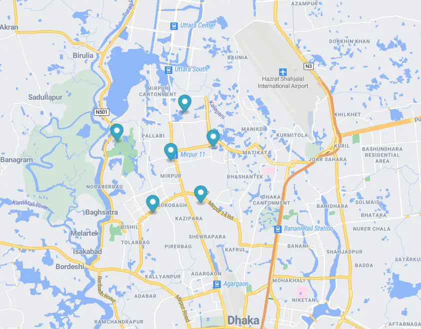
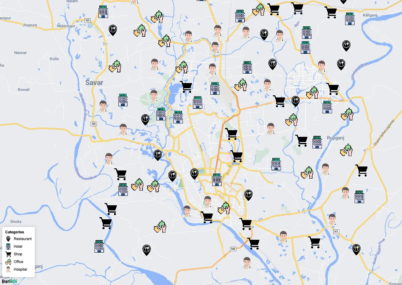
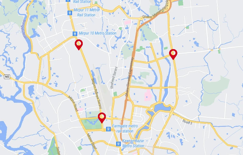
## Multiple Markers as Layer
# Multiple Markers as Layer
Render **hundreds or thousands** of markers efficiently using a `symbol` layer with dynamic icons based on categories — far more performant than individual `Marker` objects.
---
## Quick Usage
```js
map.addLayer({
id: "poi-layer",
type: "symbol",
source: "pois",
layout: {
"icon-image": ["get", "icon"], // Dynamic icon from properties
"icon-size": 0.09,
},
});
```
---
## Full Working Example
```html
Location Types

Restaurant
Hotel

Shop
Office

Hospital
```
---
## Why Use Symbol Layers?
| Method | Performance | Best For |
| ----------------------- | ------------------ | ------------------------------------- |
| `new bkoigl.Marker()` | Slow (1–100) | Few markers with rich popups |
| **Symbol Layer (this)** | Fast (100–10,000+) | Large datasets, clustering, filtering |
**Symbol layers are 10–50x faster** than individual markers.
---
## Key Layout Properties
| Property | Value Example | Purpose |
| ---------------------- | ----------------- | ------------------------------------ |
| `"icon-image"` | `["get", "icon"]` | Dynamic icon from feature properties |
| `"icon-size"` | `0.09` | Scale (0.05 = small, 0.15 = large) |
| `"icon-allow-overlap"` | `false` | Prevent stacking |
| `"icon-anchor"` | `"bottom"` | Align pin tip to coordinate |
---
## Advanced: Filter by Category
```js
// Show only restaurants
map.setFilter("pois-layer", ["==", ["get", "category"], "restaurant"]);
// Clear filter
map.setFilter("pois-layer", null);
```
---
## Advanced: Dynamic Icon Size by Zoom
```js
"icon-size": [
"interpolate",
["linear"],
["zoom"],
10, 0.06,
15, 0.12
]
```
---
Scale to thousands — effortlessly!
---
## Soft Pulsing Marker
# Soft Pulsing Marker
Add a **smooth, animated pulsing dot** that gently breathes and glows — ideal for showing live user location, real-time tracking, alerts, or emphasizing important points.
---
## Quick Usage
```js
map.addImage("pulsing-dot", pulsingDot, { pixelRatio: 2 });
map.addLayer({
id: "pulse-layer",
type: "symbol",
source: "user-location",
layout: { "icon-image": "pulsing-dot" },
});
```
Uses a **dynamic canvas-based image** that animates in real-time.
---
## Full Working Example
```html
```
---
## Customize the Pulse
| Property | Change To | Effect |
| --------------- | -------------------------- | ------------------- |
| Pulse color | `rgba(255, 100, 100, ...)` | Red pulse (alert) |
| Speed | `duration = 800` | Faster pulse |
| Size | `size = 240` | Larger dot |
| Outer radius | `0.9 * t` | Stronger pulse wave |
| Inner dot color | `rgba(255, 100, 100, 1)` | red (Emergency/SOS) |
**Popular Variants**:
- Green pulse → Live user location
- Red pulse → Emergency/SOS
---
## Advanced: Multiple Pulsing Markers
```js
// ...existing code...
features: [
{
type: "Feature",
geometry: {
type: "Point",
coordinates: [90.39, 23.79],
},
},
{
type: "Feature",
geometry: {
type: "Point",
coordinates: [90.41, 23.81],
},
},
{
type: "Feature",
geometry: {
type: "Point",
coordinates: [90.37, 23.77],
},
},
],
// ...existing code...
```
All will pulse in perfect sync!
---
## Pro Tip: Combine with Geolocation
```js
// Add a separate source for the live geolocation marker
map.addSource("pulse-point", {
type: "geojson",
data: {
type: "Feature",
geometry: {
type: "Point",
coordinates: [90.36402004477634, 23.823730671721], // default center
},
},
});
// Add layer for live geolocation marker
map.addLayer({
id: "pulse-point",
type: "symbol",
source: "pulse-point",
layout: {
"icon-image": "pulsing-dot",
},
});
// Watch user's position and update marker
navigator.geolocation.watchPosition(
(pos) => {
map.getSource("pulse-point").setData({
type: "Feature",
geometry: {
type: "Point",
coordinates: [pos.coords.longitude, pos.coords.latitude],
},
});
// Optional: center map on user's location
// map.setCenter([pos.coords.longitude, pos.coords.latitude]);
},
(error) => {
console.error("Geolocation error:", error);
},
{
enableHighAccuracy: true,
maximumAge: 0,
}
);
```
Real-time live location with pulsing effect
---
Make your map **breathe** — beautifully.
---
## Your First Barikoi Map
# Your First Barikoi Map
The fastest way to get a beautiful, interactive map on any website or app.
## Full Working Example
```html
```
---
## Code Breakdown
### 1. Required Dependencies
```html
```
| Resource | Purpose |
| ------------- | --------------------------------------------------------------------- |
| `bkoi-gl.css` | Styles for map UI elements (zoom buttons, attribution, popups, etc.) |
| `bkoi-gl.js` | Core JavaScript library that renders the map and handles interactions |
Use a specific version in production
Replace `@latest` with a fixed version like `@2.0.4` to avoid unexpected breaking changes.
:::
---
### 2. CSS Setup for Full-Screen Map
```css
body {
margin: 0; /* Remove default browser margins */
padding: 0; /* Remove default browser padding */
}
html,
body,
#map {
height: 100%; /* Map container takes full viewport height */
width: 100%; /* Map container takes full viewport width */
}
```
Why is this necessary?
Without these styles, the map container would have **zero height** and nothing would be visible. The map needs explicit dimensions to render.
:::
---
### 3. Map Container Element
```html
```
This empty `
` is where Barikoi GL injects the interactive map canvas. The `id="map"` must match the `container` property in the JavaScript initialization.
---
### 4. Initialize the Map
```js
const map = new bkoigl.Map({
container: "map", // Target element ID
style: "https://map.barikoi.com/styles/barikoi-light/style.json", // Map style URL
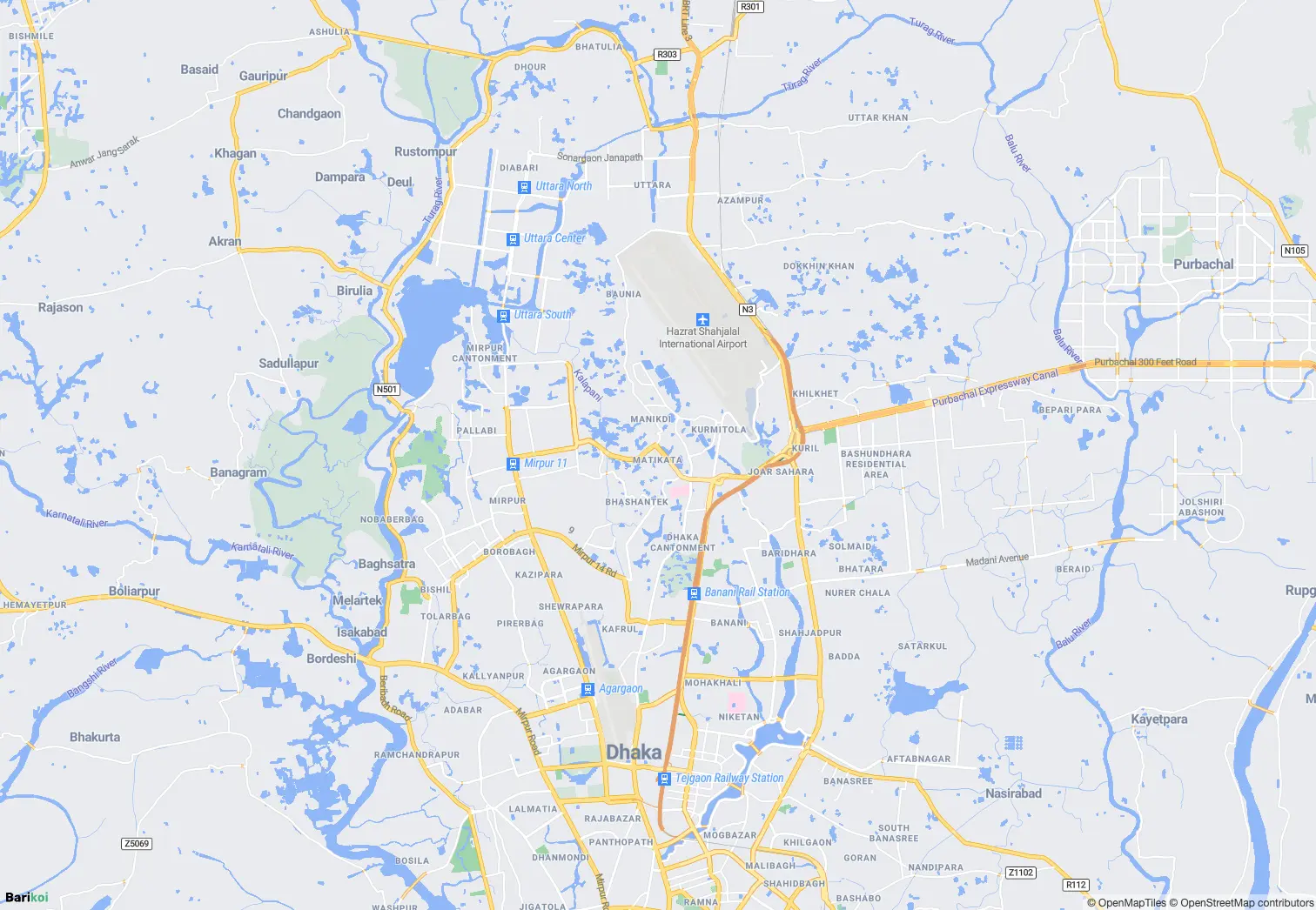
center: [90.4071, 23.7925], // [longitude, latitude]
zoom: 11, // Zoom level (0-22)
accessToken: "YOUR_BARIKOI_API_KEY", // Your API key
});
```
#### Configuration Options Explained
| Option | Type | Description |
| ------------- | ------------ | -------------------------------------------------------------------------------- |
| `container` | `string` | The `id` of the HTML element where the map will render |
| `style` | `string` | URL to a Barikoi map style JSON (defines colors, fonts, layers, etc.) |
| `center` | `[lng, lat]` | Initial map center coordinates — **longitude first!** |
| `zoom` | `number` | Initial zoom level: `0` = world view, `22` = building level |
| `accessToken` | `string` | Your Barikoi API key from [developer.barikoi.com](https://developer.barikoi.com) |
Common Mistake: Coordinate Order
Barikoi GL uses **`[longitude, latitude]`** (like GeoJSON), not `[latitude, longitude]` (like Google Maps). Dhaka is `[90.4071, 23.7925]`, not `[23.7925, 90.4071]`.
:::
---
## Quick Reference: Zoom Levels
| Zoom Level | What You See |
| ---------- | ---------------------- |
| `0-3` | Continents / Countries |
| `4-6` | Large regions |
| `7-10` | Cities |
| `11-14` | Neighborhoods |
| `15-18` | Streets |
| `19-22` | Buildings |
---
---
==============================================================================
11. BEST PRACTICES
==============================================================================
## API Key Security
- Use environment variables for API keys
- Never expose keys in client-side code in production
- Consider using a backend proxy for API calls
## Error Handling
- Always implement try-catch for API calls
- Provide fallback UI for failed map loads
- Handle network errors gracefully
- Use proper loading indicators for async operations
## Performance Optimization
- Use debouncing for autocomplete (300-500ms delay)
- Implement lazy loading for map SDKs
- Cache frequently accessed data like district information
- Remove map instances properly on component unmount
## Coordinate Format
- Remember: Barikoi uses [longitude, latitude] format
- Google Maps uses {lat, lng} objects
- Create utility functions for conversion if needed
## Cleanup
- Always remove map instance on component unmount
- Remove markers and popups when replacing them
- Cancel pending API requests on cleanup
## Bangladesh-Specific Considerations
- All coordinates use [longitude, latitude] format
- Default view focuses on Bangladesh (Dhaka: [90.4125, 23.8103])
- Administrative divisions: Division, District, Thana/Upazila, Union
- Support for both English and Bangla interfaces
- Detailed administrative boundary data for Bangladesh
===============================================================================
RESOURCES
===============================================================================
Documentation: https://docs.barikoi.com/
Developer Portal: https://developer.barikoi.com/
API Reference: https://docs.barikoi.com/api
Copyright © 2026 Barikoi Technologies Limited
 {style.name}
))}
{style.name}
))}